|
AGWTracker
 Current Version is 2007.709(9JUL2007) Current Version is 2007.709(9JUL2007)
Added the Ability to define Alarm Areas and be notified when a station Enters or leaves the area. (Circular and Complex Polygon Alarms).
Now support Online Mapping (Virtual Earth , Google Maps and Yahoo Maps).
Support for Shape file maps, Polish Format and Garmin Image files (Vector).
Multilingual (Arabic, Bulgarian, Chinese (simplified and Traditional), Croatian, Danish, Dutch, French, English, German, Greek, Italian, Japanese, Norwegian, Polish, Portuguese, Romanian, Spanish, Swedish ).If you wish to translate it drop me an email, you will get free registrations for Packet Engine Pro and AGWTracker.
Added Overlay Maps. Add additional Maps over existing.
You can adjust the transparency of Overlay Maps.
You can adjust the Contrast of the Map Views.
APRS Server full Support!! (At Last).
Can transmit now your weather station data.
Ability to see how your message is displayed on Kenwood Radios.
Added satellite and signal strength display on GPS view.
 General General
This is a shareware Program and costs 49$USD. It works with no trial period timeout. It is an APRS(c) compatible program. It works using AGW Packet Engine or Packet Engine Pro. I decided to write it because i wanted more functionality...
Features.
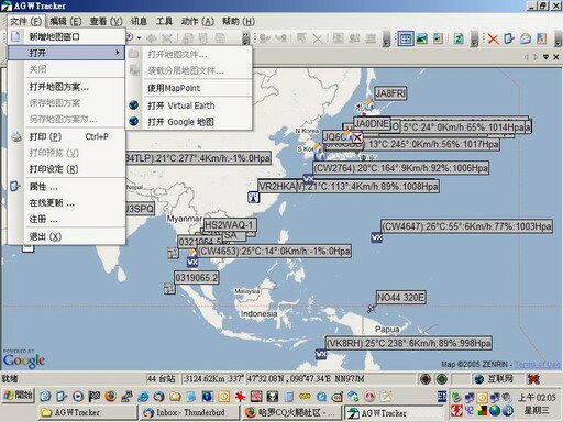
Chinese Version
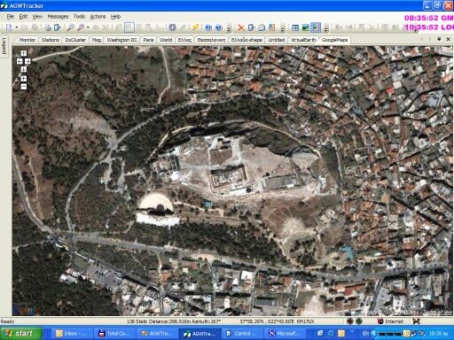
Athens Acropolis (online Google Maps)
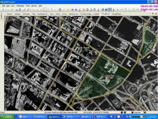
USA/New York (online Virtual Earth)
Microsoft MapPoint
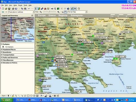
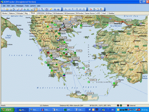
 Multiple maps (all loaded) for instance access from the Tab list. Multiple maps (all loaded) for instance access from the Tab list.
You can see also the Overlay Maps. Down at Crete Island the East Part!
Click on the Map to see full Picture!
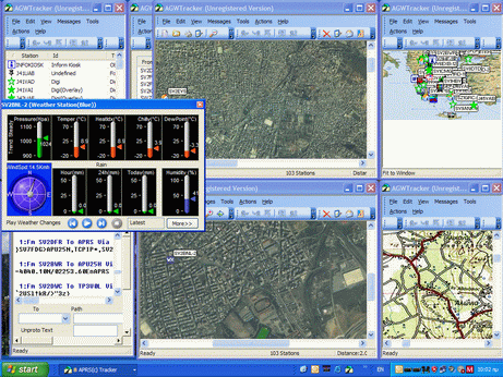
 Multiple Maps as separated windows on the desktop. Multiple Maps as separated windows on the desktop.
Click on the Map to see full Picture!
 Overlay Maps. Ability to adjust the transparency of overlays. Overlay Maps. Ability to adjust the transparency of overlays.
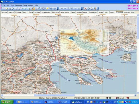
 Very Large Map Files. This is a Geotiff 86Mb file. Very Large Map Files. This is a Geotiff 86Mb file.
Fit to Window
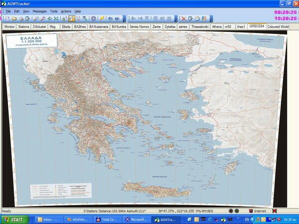
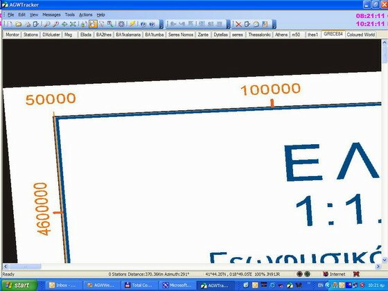
Original Size
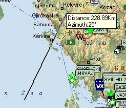
 Distance Calculator Mode. To measure distance and Azimuth. Distance Calculator Mode. To measure distance and Azimuth.
 Pan Mode. Pan Mode.
lick and drag the Map to move it if it is larger than your screen. You don't have to use the scrollbars.
 Eagle Eye mode. Eagle Eye mode.
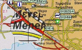
 Fit To Window. Fit To Window.
The map is enlarged or shrinked to fit the size of the program's window.
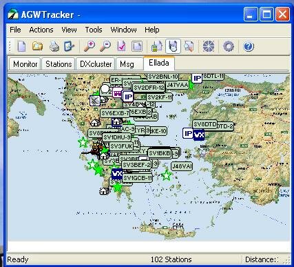
 Zoom. Zoom.
You can Zoom in or Zoom out in 10% steps.
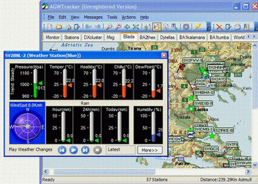
 Weather. Weather.
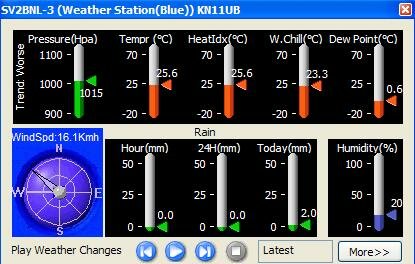
The Weather station dialog displays..
Pressure
Temperature
Heat Index. It is the Temperature you feel during hot Summer days.
Wind Chilly. It is the temperature you feel during cold Winter days.
Dew Point.
Rain
Humidity
Wind Speed and direction.
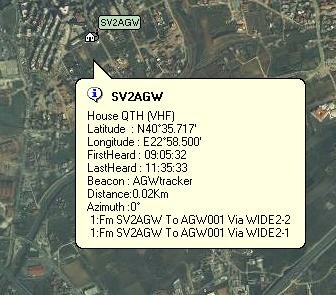
 Tooltips. Tooltips.
Move the mouse over Stations and you have a tool tip giving you all the information, instantly.
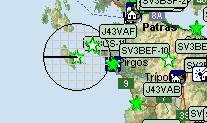
 Draw Coverage Area. Draw Coverage Area.
Draws a circle indicating the area the station covers.
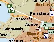
 Tracking a vehicle Tracking a vehicle
Here you can observe the route that SV2GSX-9 drives. Come back at home and see where you were....
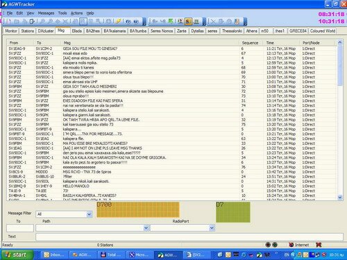
 Ability to See how your message is displayed on Kenwood Radios. Ability to See how your message is displayed on Kenwood Radios.
 Computer Requirements Computer Requirements
- Windows 98/ME/2000/XP (will not work with DOS; not recommended for Windows 3.1 ,Win98 and Windows NT)
- Windows Common Control 5.0+ upgrade for Win 98/2000
- minimum 5 MB hard drive space
Before registering, use the trial period to determine if it is ok for you.
 Registration and Fees Registration and Fees
The program provides free unlimited trial period, but you will need to register and pay a fee of $49 USD if you find it useful.
You can register and pay by contacting BMT, a company that handles my registrations. You can register from {their web site} (there is also an internet registration link within the program) or by fax or by toll free telephone. You can pay with most credit cards or by money order, personal check, Euro check, and some other options.
After you register, I will send you a registration key to enter into the program 'Registration' screen. To ensure you receive your registration key as quickly as possible, please include the following info in the "Comments" section of your order form:
1. You Name.
2. Your Callsign
3. The "Key to Send" string that the program generates from the 'Registration' screen.
4. The way you wish to receive your registration number - specify you Email or Postal Address.
5. A phone number -- in case of a problem
More on how to register.
More on payment methods.
A secure URL to register online now with a credit card.
© 1998-2007 SV2AGW (George Rossopoulos) . All rights reserved.
|